It's
Not My Fault Devil's
Golf Course WildFlowers
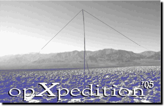
It's Not My Fault! opXpedition
Background:
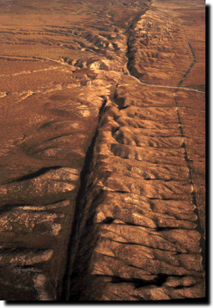
Just east of Paso Robles lies the Carrizo Plain. It sits in an area
where the San Andreas fault is clearly visible, where two tectonic plates grind
against each other.
Our goal will be to transmit from the two tectonic
plates by transversing the fault line with a wire antenna.
This particular area along
the fault is the most seismically active portions of the San Andreas
within California. Parkfield lies nearby, the earthquake capitol
of California.
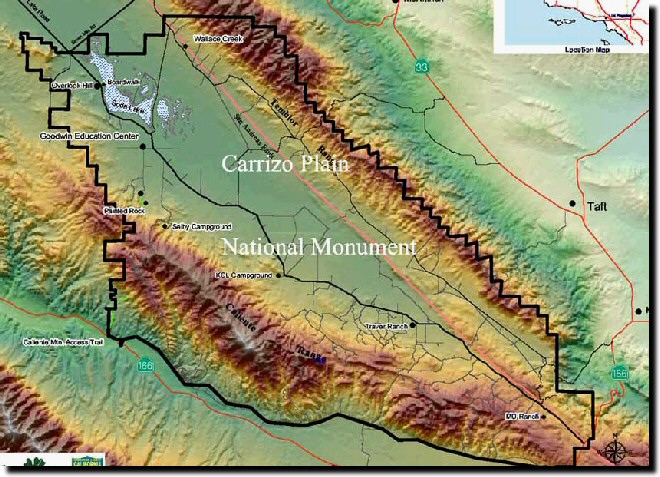
This relief map of the Carrizo Plain shows
the San Andreas fault line in the eastern portion of the National
Monument. Our target will be Wallace Creek, seen in top of
the map.
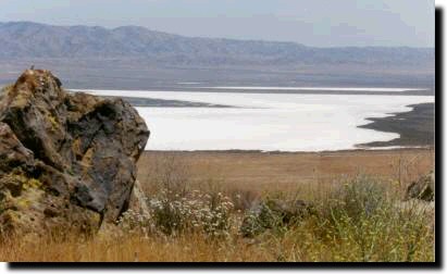
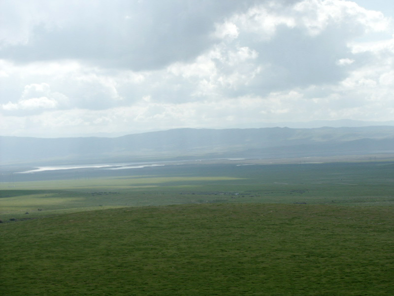
Nearby is Soda Lake, one
of the one of the largest undisturbed alkali wetlands in California.
The 3,000 acre ephemeral lake provides important habitat for migratory
birds and is surrounded by a rare plant community. With no outlet,
the water that pools in the lake during the winter evaporates, leaving
behind a glistening expanse of sulphate and carbonate salts.
Salt!!!! Pure salt dozens of
feet deep. Nothing like a saltpan to set up antennas! You
can be sure we'll set up a vertical array here.
Turns out
that the last time this portion of the fault moved was in 1857. It's this
area that people believe will cause the falling into the sea type of earthquake.
Maybe we should do some research about RF exposure to faults. I
can just see the headlines now ..."amateur radio operator responsible for
triggering "the big one"...millions flee quake zone."
UPDATE: 2/6/2005: "The
Scouting Trip"
While (nearly) everyone else was busy watching
the SuperBowl, the XYL, the K9 and I packed up our eurotrash van and
set out to do a little scouting on the Carrizo Plain in preparation for our
opXpedition. We approached the Plain from the north on Hwy 58. As
we entered the Plain, we were impressed by the greenery. The recent rains had
the effect of turning the normally brown landscape into a sea of green. We
quickly found a road that went east in the direction of the San Andreas fault.
We made our way up a small hill that overlooked the Plain.
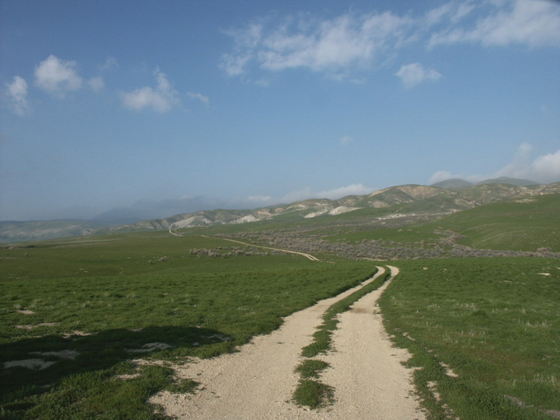
In the picture above, those hills are actually
the San Andreas Fault. We didn't drive right up to the edge of the fault
as the road that would have given us access was closed off by a gate. We'll
have to do a little investigating to find the property owner and see if we can
get permission to cross their land.
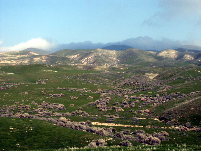
Above, looking in the opposite direction
from the fault, we can see the expanse of the Carrizo Plain to Soda Lake
that is still partially filled with water from the storms in January. Green
and more green in all directions. It was really amazing to see. This
area is usually quite dry and brown. These pictures will most certainly
be in sharp contrast to the pictures we will take during the opXpedition in
about a month. Notice the lack of any trees? We did, there weren't
any anywhere as far as you could see in all directions. One could
well imagine the area during a wind storm...a perfect place to fly a kite.
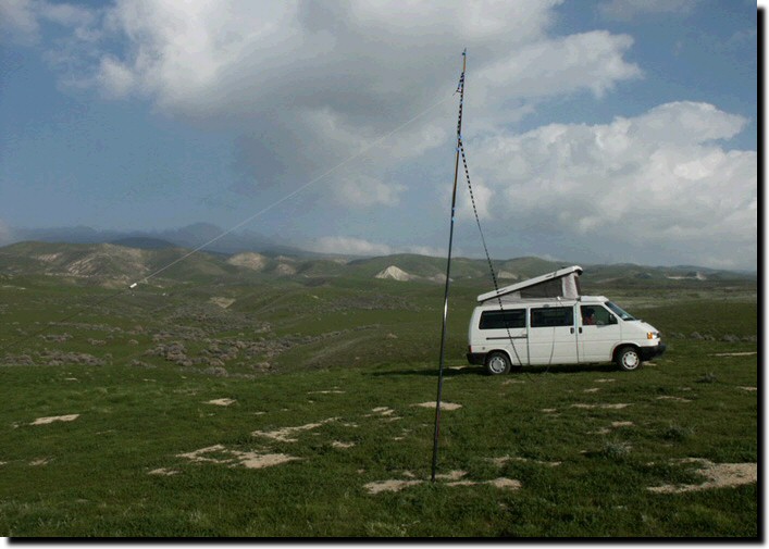
I set up my 17 meter 1/2 wave dipole and
starting making contacts. I made about 30 contacts during the hour I spent
calling cq. I described our location and the purpose of our scouting trip.
That little dipole works pretty well. This was the second time I
used it; the other being in Death Valley. It sure does make a difference
working out in the field far away from any noise sources. What a pleasure
to hear pure natural band noise. I got mostly 5x7, 5x9 signal reports.
Don, WV4X (one of my friends) in Virginia set the record for the biggest
signal at +40db over s9.
We packed up after the hour was up and
headed off across the Plain to Soda Lake. As we drove across the Plain,
there were these perfectly laid out roads with road sign posts everywhere. It
appeared that sometime in the past, someone tried to develop the area for housing.
There were a few "houses" here and there...mostly trailers and
collections of old vehicles (aka:junk yards). Given the beauty of the
area, these places were real eyesores. But mostly the Carrizo Plain is
a vast expanse of flatland. We drove back going south along Soda Lake
road which turned out to be a 40 mile dirt road that our dog didn't much care
for. At one point, just before we entered Hwy 166, we drove right through
the San Andreas fault which was clearly visible. I think we'll avoid Soda
Lake road the next time through.
Contact Log:
|
Starting time:
|
2220z
|
|
Operating frequency:
|
18.155 MHZ
|
|
Contacts:
|
|
|
K4FSI
|
KE5AMB
|
|
VE7EIY
|
WA4NGR
|
|
N4KCU
|
W5TMC
|
|
KC5ABJ
|
KA4ICK
|
|
KG4WTO
|
KV1P
|
|
N5YPK
|
KE5AHK
|
|
KB1JHG
|
WM4U
|
|
N5HCK
|
WA5UA
|
|
KD4GLS
|
WV4X
|
|
W5QGG
|
K4ZOO
|
|
W5TOM
|
AD7CV
|
|
KD4EG
|
KB5BZT
|
|
KA4FDO
|
NU7U
|
|
LOG-OFF:
|
2330Z
|
It's
Not My Fault Devil's
Golf Course WildFlowers
|